This post contains affiliate links. If you make a purchase through a link below, I may earn a commission at no extra cost to you. Thank you so much! I only recommend products I use or believe will be something you’ll love!
Shroud Cay Mooring Ball
Weather
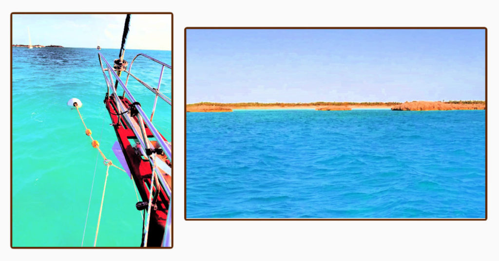
After a few days anchored at Highbourne Cay, we headed towards Shroud Cay to secure a mooring ball for the next weather front on its way.
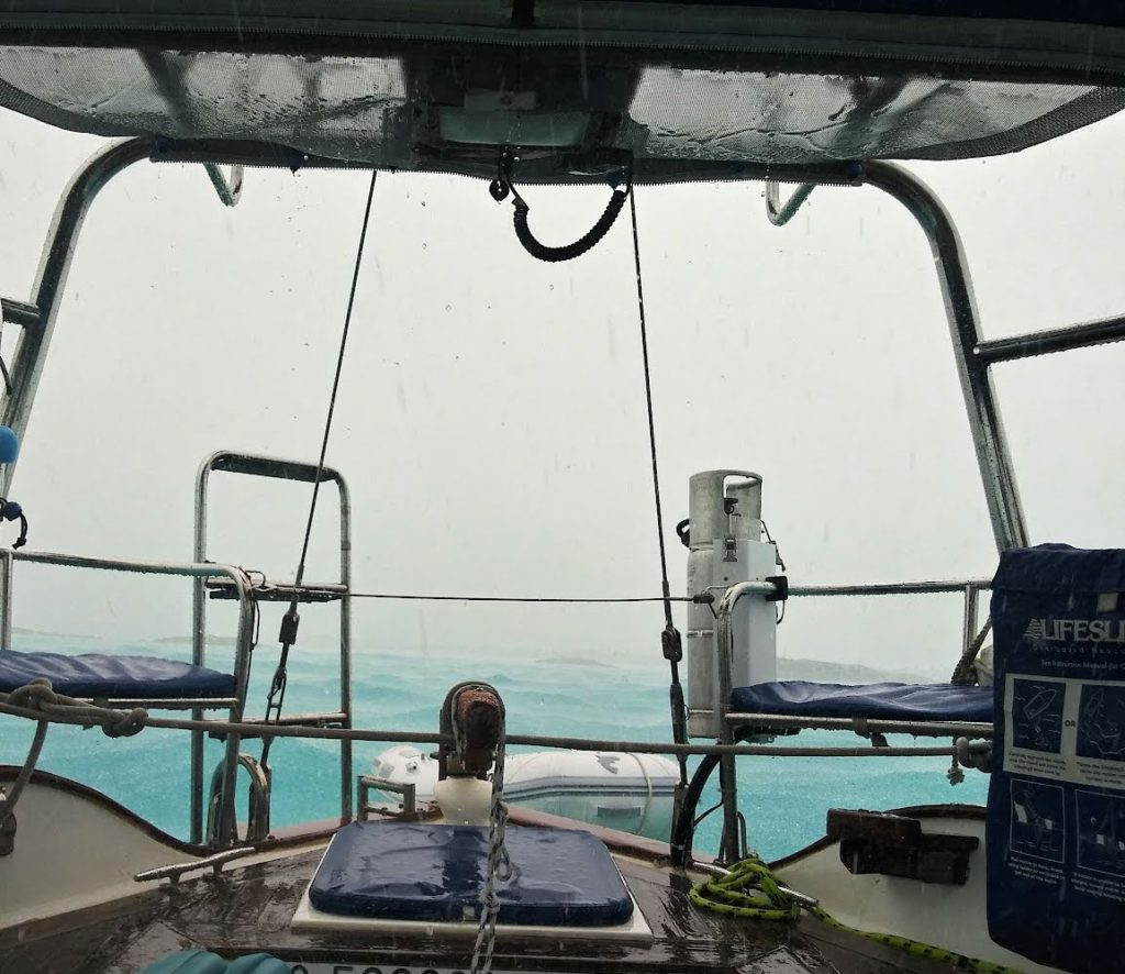
We hung out on the mooring ball for a few days before getting to explore Shroud Cay. From our cockpit, we could see many little rocky islets, a few small beaches, and lots of mangroves. Although we were anxious to explore the mangrove-lined creeks by dinghy, we waited. It would not be safe to try and get our dinghy motor down from Terrapin’s motor mount and onto the dinghy with everything bouncing up and down with the waves. We sat tight during the days of wind, waves, and rain. Patience, patience, we can’t control the weather!
Let’s Cook Together!
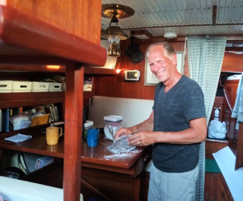
Normally, Tony isn’t too eager to help in the galley, but with no place to go, he agreed to help me make tortillas. We eat a lot of tortillas onboard. Having a tortilla press helps with the process.
Cooking in the cabin together reminded us of many Hallmark movie scenes of couples working together in the kitchen, aww… a “Hallmark moment!”
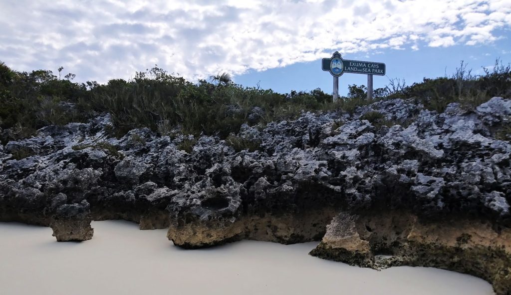
Exuma Land and Sea Park
When the weather cleared, the Exuma Land and Sea Park Warden’s boat made the rounds in the mooring field to collect fees. They explained payment options such as a drop box located on the island or using their online system or we could pay the Warden directly or online. In our conversation with them, we mentioned that we had purchased an Exumas Cays Land and Sea Park membership to support the park. They said our membership includes a couple of free nights at a mooring ball. What a great bonus to support an important cause.
Shroud Cay Highlight: Dinghy ride through Sanctuary Creek
Our patience for the weather to clear proved to be worth it. We finally got our dinghy motor down and off we went! We used this map from a cruiser’s site to help us know where the creek and paths were located.
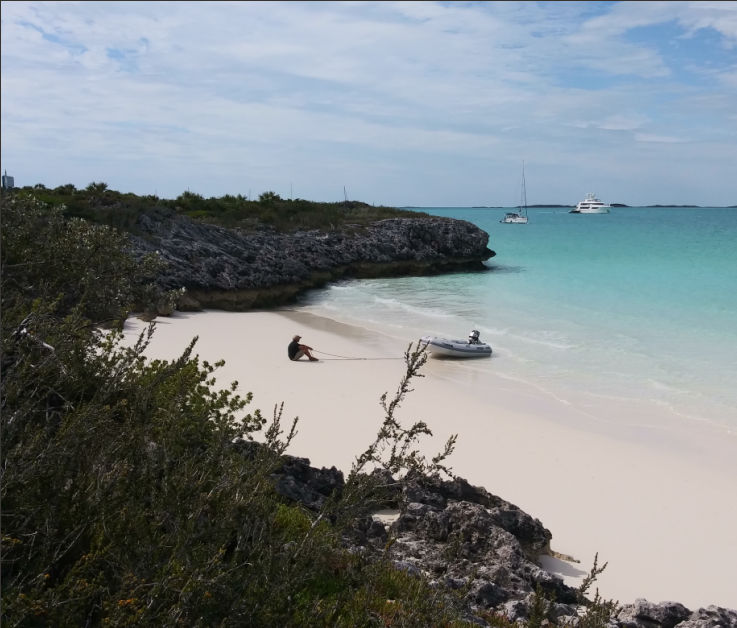
First, we stopped off at one of the little beaches tucked along the shoreline between rocky islets and mangroves. We could see the park payment box on this island and knew there was a hiking trail to a well here. Tony enjoyed relaxing in the cove while I scoped out the hiking trail to the well. We both had a little adjustment to being on land after a couple of days of constant motion from the waves. We call it “land sick” when we feel a little unsteady on our feet.
Sanctuary Creek Dinghy Ride
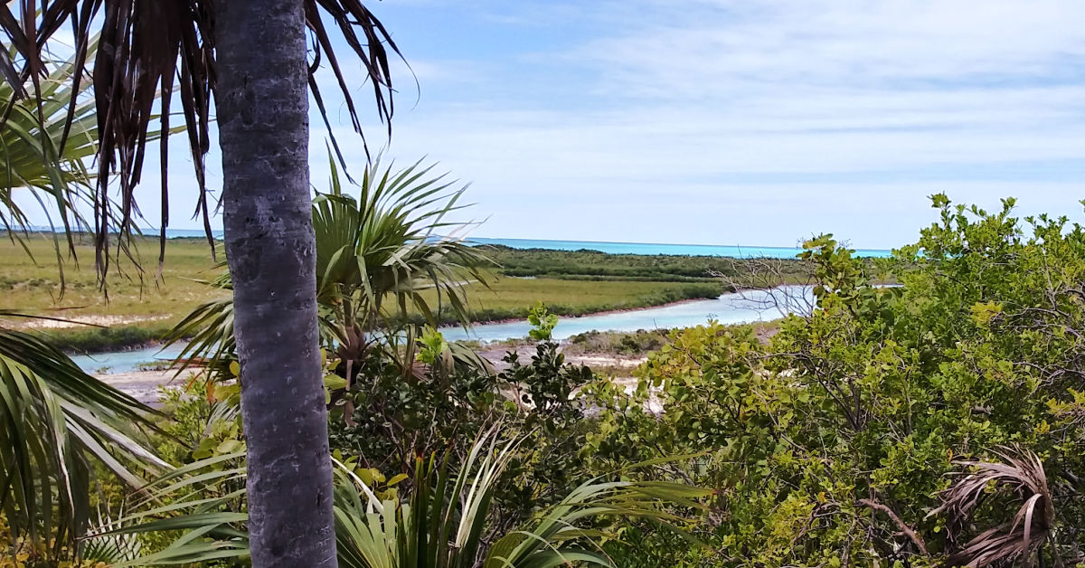
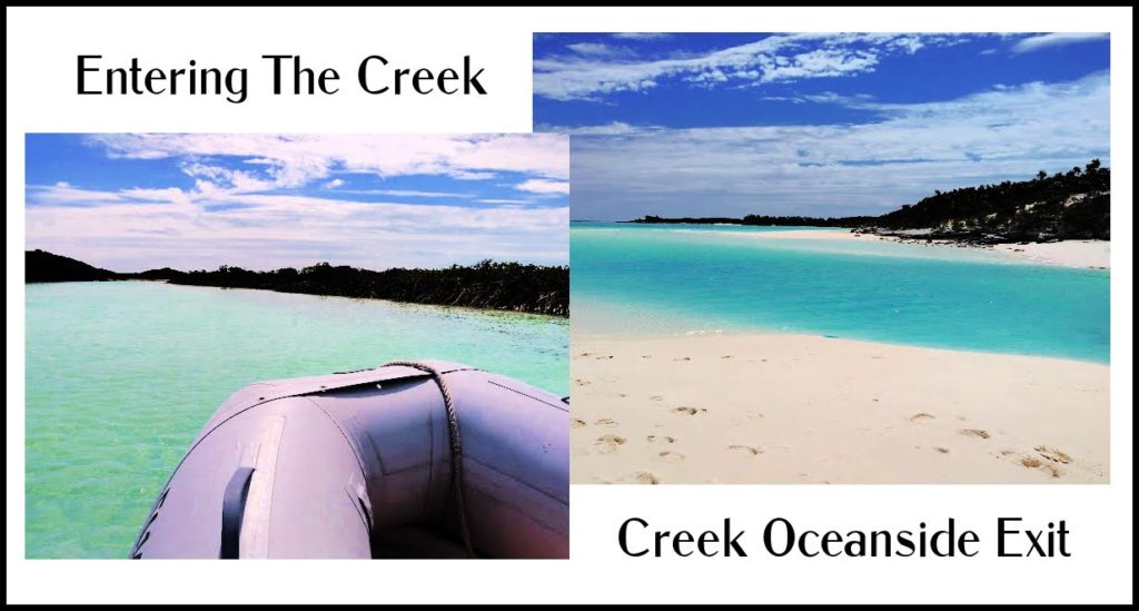
Back in the dinghy, we headed out and around a line of shallow rocky islets to reach the entrance to Sanctuary Creek, a shallow mangrove-lined cut that goes from the bank’s side to the ocean sound. Dinghies are allowed on the creek, but at a slow speed only. Since the creek is so shallow, it is important to be aware of the tide. We entered the creek on a rising tide to have enough water to navigate to the ocean side and back without getting stranded due to low water.
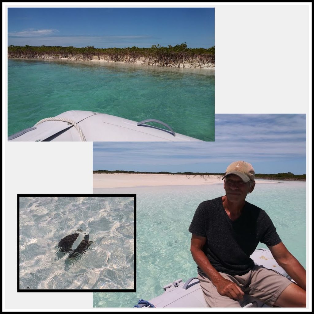
The entrance to the creek was a bit turbulent, like mini rapids. Once inside, we kept a good lookout for shallow sand bars throughout the creek and maneuvered around them. As the tide rose, we didn’t worry as much about the depth and were able to focus on spotting the rays, turtles, and fish. Meandering through the creek felt like being on a Disneyworld ride, except this was all natural! We lost track of how many turtles we saw swim by in the clear water!
The last bend of the creek brought a view of the pristine, white Driftwood beach and the open ocean of Exuma Sound. It looked like a perfect postcard! This is a perfect swimming spot and a natural water slide when the tide is running. Next time we’ll wear our swimsuits when we come here!
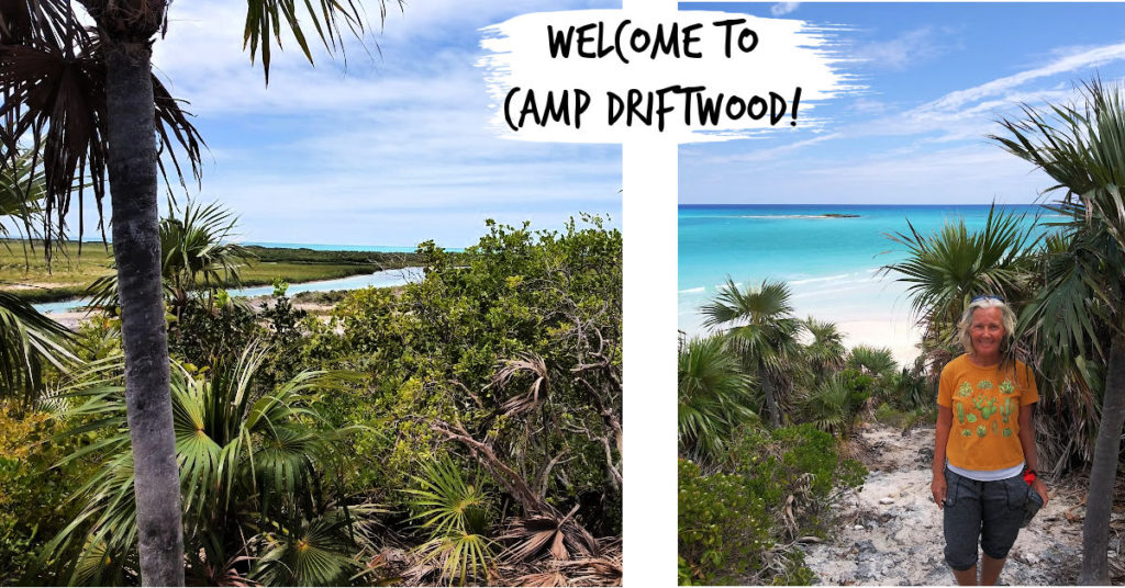
Camp Driftwood
We parked our dinghy next to another cruising couple’s dinghy who had arrived before us. They were just returning from a hike up to Camp Driftwood and pointed the way for us. We grabbed our hiking shoes of choice, Keens, and hiked up the trail. What a gorgeous bird’s eye view in all directions from Driftwood lookout! Look one way and you see the mangroves and creeks and turn the other way and you see the varying shades of blues in the ocean! And if you have binoculars, you may be able to see Norman’s Cay airstrip in the distance.
Legend has it that this lookout spot was the site of the DEA because of the view of Norman’s Cay. Between 1978 and 1982 Norman’s Cay was used by Carlos Lehder’s drug smuggling operation. The DEA positioned themselves here to observe and track the planes coming and going from the island’s airstrip.
Our dinghy excursion back through the creek to Terrapin was tranquil and relaxing. Until we reached the opening to our anchorage and were met with an oncoming wind. More waves and more splashes up over the dinghy. We were soaked by the time we reached Terrapin. Oh well, didn’t we want to take a swim when we were at the beach?!
We’re so glad we lingered here to explore this northernmost cay in Exuma Land and Sea Park.
Now let’s head to another island in the park!”
Thanks For Sailing Along!
Before you go, make sure to subscribe so that you don’t miss out on any blog posts!